Fanmade Interactive Map
Beta version: Some entries need polishing and proper credit to theory sources (Reddit & the wiki).
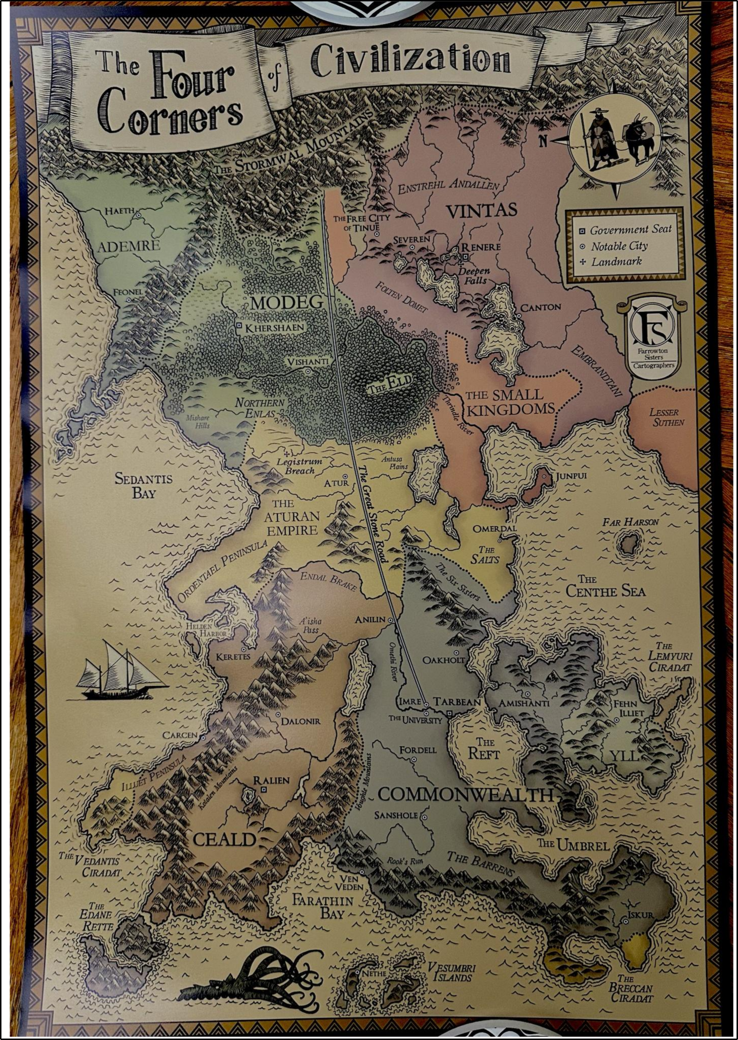
Map source:
Worldbuilders
.
Compare official versions:
Map Comparator
.
Unlocated Places
Fan-theories or locations not confirmed on official maps:
Frequently Asked Questions:
Where is Kote’s Waystone Inn
In the "present day", the Inn stands in a town called Newarre, possibly somewhere in Vintas. We don’t know for certain — likely by design, since it’s hard to go to a place called “nowhere.”
Why is the map oriented to the east instead of the north?
There is no concrete reason why a map should orient north “up.” In real life, maps have been oriented in all directions depending on custom and purpose. But honestly, good question. It might be worth considering the cultural significance of directionality in the world of the story — notice that this map is made in-universe by the Farrowton sisters. Also, there is no magnetic north in this world.
What is the name of this world?
Temerant
What is the scale?
There isn’t a precise scale and is not mean to have one — the map was likely produced with technology less "advanced" than ours and something something magic. That said, we can try to estimate distances from details mentioned in the books. For example, walking from Imre to the University is about 2–3 miles. Knock yourself out doing the math.
Why are some areas clickable while other not?
Only the areas with known information are clickable; the others are not because we don’t know anything about them. I allowed myself to add speculation to some, but this new map introduces completely new names.
Special Thanks & Contributors
Fanmade, non-commercial project. Huge appreciation to the community keeping the lore alive:
- Lore & theories: r/KingkillerChronicle discussions and the Kingkiller Wiki editors for timelines, names, and clarifications.
- Map sources: Nate Taylor for this illustration of the map and reddit user u/ohohook for his photograph.
- Feedback & QA: u/LostInStories222, u/BioLogIn and friends from the fandom who spotted typos, missing places, and clunky tooltips.
- Inspiration: Patrick Rothfuss and the broader fan community creating theories, art, and acoustic infodumps.